Sydney Metro
Maps, timetables, tickets, Opal and a route planner — everything about Sydney’s train network in one place.
Service monitoring
Sydney Metro status
Service status · updated in real time
North Shore & Western
Inner West, Leppington & Liverpool
Eastern Suburbs & Illawarra
Cumberland
Airport & South
Northern
Sydney Metro · driverless
Welcome to Sydney Metro
Welcome to metrosydney.org, an independent guide to Sydney’s metropolitan train network, run by Sydney Trains under Transport for NSW. The network has 10 train lines and 174 stations spanning about 369 km — from Berowra and Hornsby in the north to Macarthur and Waterfall in the south, and from Emu Plains at the foot of the Blue Mountains east across the Harbour to Bondi Junction and Cronulla.
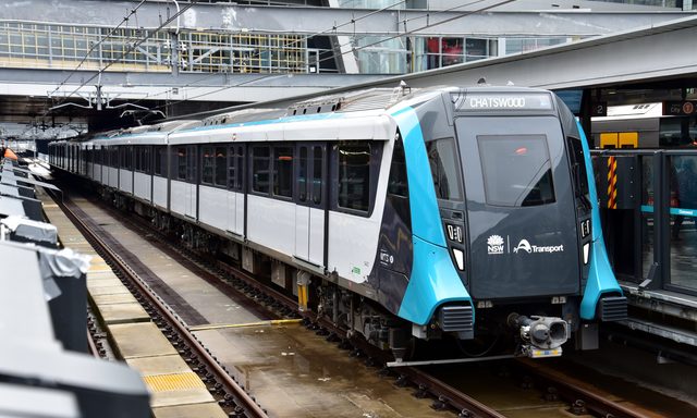
The network now includes the driverless Sydney Metro (M1), which runs through a new tunnel under the harbour and CBD, while the Sydney Trains lines fan out across the city — several looping the underground City Circle. Here you’ll find a page for every line and station, an interactive map, timetables, Opal and ticket information, and a route planner.
The lines at a glance
T1 North Shore & Western line
T2 Leppington & Inner West line
T3 Liverpool & Inner West line
T4 Eastern Suburbs & Illawarra line
T5 Cumberland line
T6 Lidcombe & Bankstown line
T7 Olympic Park line
T8 Airport & South line
T9 Northern line
M1 Sydney Metro line
T1 Richmond line
T4 Cronulla line
369 km · 174 stations · 10 train lines across Sydney
From Central out to the suburbs — the fastest way to move around Sydney, every day.
Plan your trip
Pick a start and a destination — the planner shows the fastest route, where to change and the estimated travel time.
Open route plannerPopular trips
Tickets and Opal fares
Frequently asked questions
Sydney has 9 Sydney Trains lines (T1–T9) plus the driverless M1 Sydney Metro — 10 lines in all, serving 174 stations. Each line has its own colour on the network map (T1 orange, T2 light blue, T3 orange-red, T4 dark blue, T8 green, T9 red and the M1 Metro teal), and the T1 and T4 also run the Richmond and Cronulla branches.
First trains run from around 4:30–5:00 am and the last services finish around midnight. Overnight — roughly midnight to 4:30 am — the NightRide bus network replaces trains and the Metro, running about hourly along each line.
Opal fares are distance-based: a single Adult trip runs from $4.33 (short trips) up to $10.66 (longest), and is 30% cheaper off-peak. The daily cap is $19.30 (Mon–Thu) and $9.65 on weekends, with a $50.00 weekly cap. Children under 4 travel free.
Opal is the tap-on/tap-off card for all Sydney public transport. You can also tap a contactless bank card or phone — the fare is the same and counts towards the same caps. Touch on before you board and touch off when you finish so the correct fare is charged.
Sydney Metro is Australia’s first fully automated, driverless metro. The M1 line runs from Tallawong in the north-west through Chatswood and a new tunnel under the harbour and CBD to Sydenham, with the extension to Bankstown opening soon. Trains turn up every few minutes — no timetable needed.
The free Opal Travel app shows live departures, plans journeys door-to-door and sends service alerts for the whole network.