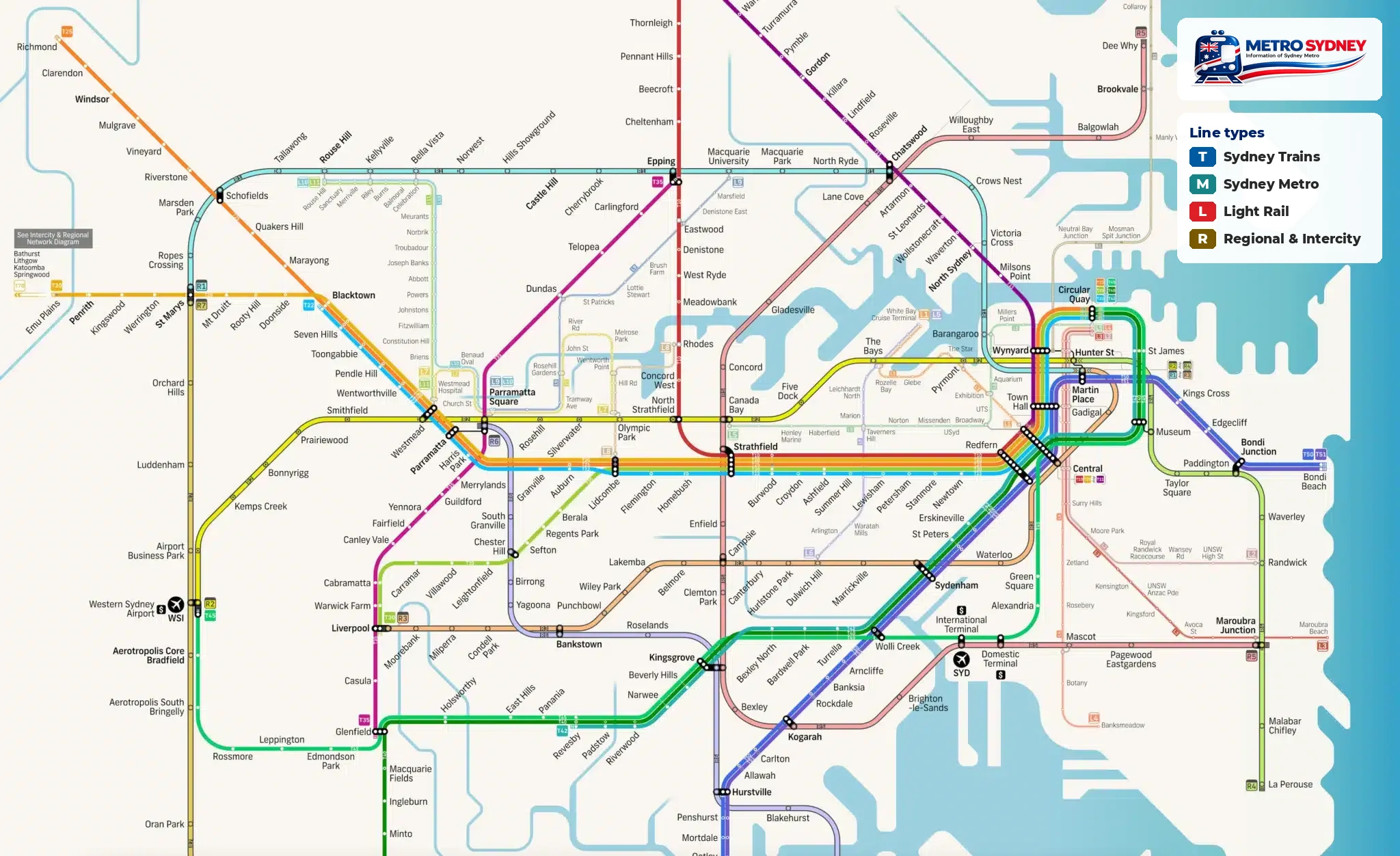
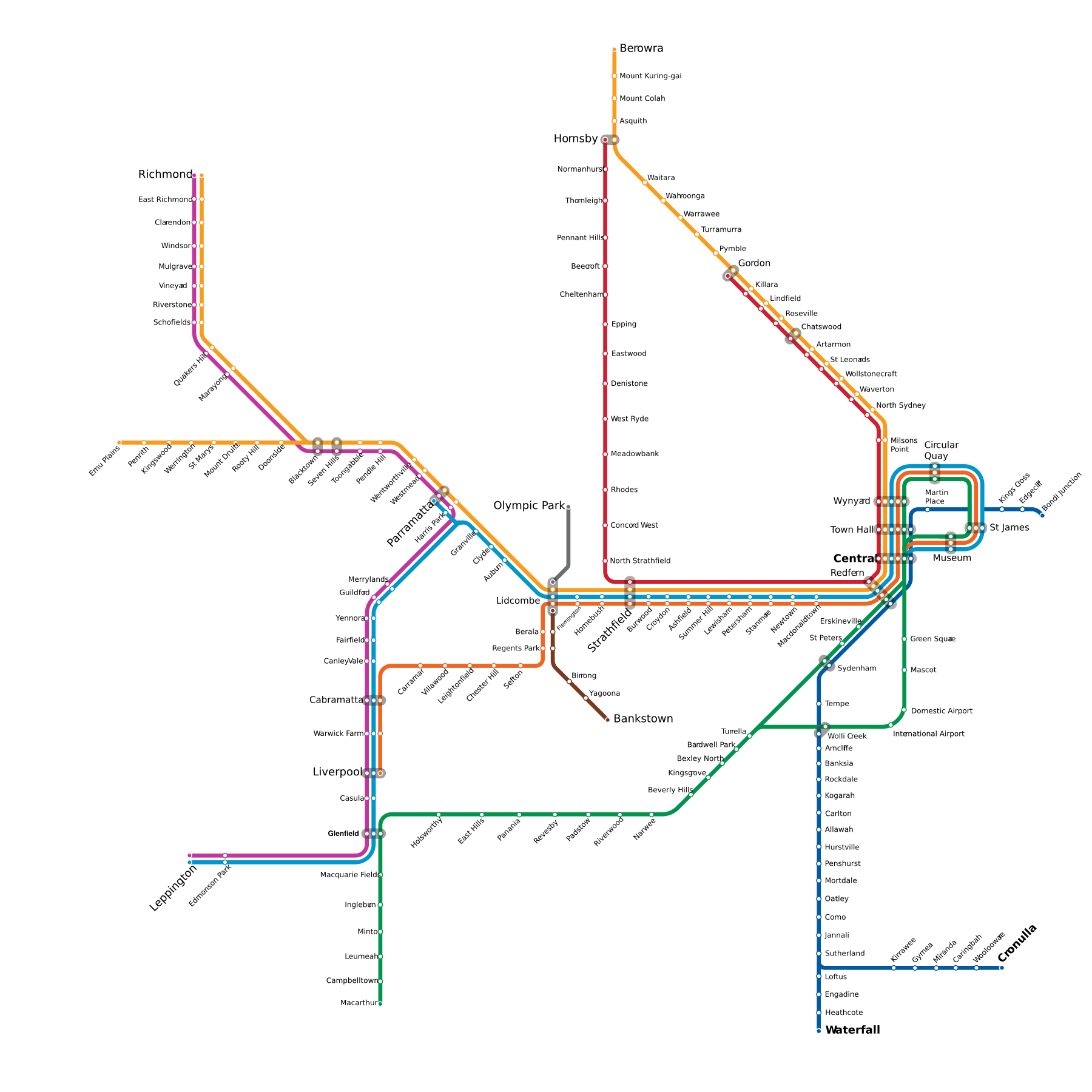
T1T1 North Shore & Western line
Berowra ↔ Emu Plains
46 stations · Sydney Trains
T2T2 Leppington & Inner West line
Museum ↔ Leppington
35 stations · Sydney Trains
T3T3 Liverpool & Inner West line
Museum ↔ Liverpool
30 stations · Sydney Trains
T4T4 Eastern Suburbs & Illawarra line
Bondi Junction ↔ Waterfall
27 stations · Sydney Trains
T5T5 Cumberland line
Leppington ↔ Schofields
23 stations · Sydney Trains
T6T6 Lidcombe & Bankstown line
Lidcombe ↔ Bankstown
6 stations · Sydney Trains
T7T7 Olympic Park line
Lidcombe ↔ Olympic Park
2 stations · Sydney Trains
T8T8 Airport & South line
Museum ↔ Macarthur
30 stations · Sydney Trains
T9T9 Northern line
Hornsby ↔ Gordon
31 stations · Sydney Trains
M1M1 Sydney Metro line
Tallawong ↔ Sydenham
21 stations · Sydney Metro
T1T1 Richmond line
Blacktown ↔ Richmond
11 stations · Sydney Trains
T4T4 Cronulla line
Sutherland ↔ Cronulla
7 stations · Sydney Trains
